• jungle trees

    Teacher Professional Learning

    Professional development workshop for middle and high school teachers that engages participants in stormwater management and green infrastructure curriculum relevant to their community through the use of online mapping and modeling tools.

About TPL

We're rebooting our Teacher Professional Learning (TPL) program, thanks to a grant from the Environmental Protection Agency! Below are the timeline and general overview of the new version of the program. Additional details will be added soon.

Fall/Winter 2024


Educators will receive professional development training focused on stormwater management and green infrastructure. UConn faculty will support educators as they carry out the curriculum in their classrooms.

Students will use a watershed-modeling web app to analyze real land use and soil data in their neighborhoods, model stormwater runoff and water-quality impacts, and compare how different conservation or development scenarios could modify runoff and water quality.

Spring 2025


Participating school groups from target towns (Bloomfield, Hartford, and Windham) will then be guided through planning and implementing local green infrastructure projects either on their school property or in the nearby community.

Local projects will 1) include planting trees, rainwater harvesting, building/installation of planter boxes, bioswales, rain gardens, green roofs, and/or permeable pavements and 2) be explicitly connected to lessons that introduce students to green careers.

Join us! Teachers, if you're interested in participating in the revised TPL program, want to learn more, or stay updated, click the orange button to access our short contact form. We're specifically targeting teachers from Bloomfield, Hartford, and Windham, but will likely have space to open the training up to educators in other districts.

TPL was originally formed under the partnership of faculty from UConn's Center for Land Use Education & Research (CLEAR), Department of Natural Resources & the Environment, Center for Environmental Sciences and Engineering (CESE), and Neag School of Education. We're also excited to also include the Connecticut Institute of Water Resources. TPL provides hands-on training in natural resources management (focusing on water) and online geospatial tools. Learn more about TPL 2.0 in UConn Today...

Training [TPL 1.0]

The theme of TPL is water, weaving in all three dimensions of the Next Generation Science Standards (NGSS) framework: core ideas, key practices, and cross-cutting concepts. TPL focuses on the connections between land use and water resource health. We start globally but quickly narrow in on Connecticut. Concepts are explored in the classroom but also in a half-day field tour of the UConn campus, which is known for its innovative stormwater management practices. Participants are taught how to use existing online mapping tools to explore these concepts for themselves in ways that align with NGSS, and for their particular geographic area of interest. All participants leave the workshop with 10-15 lessons in a Water & Sustainability Unit developed by UConn Neag School of Education researchers and are aligned with the Performance Expectation bundles listed below.

  • Earth and Human Activity (HS-ESS3-3, HS-ESS3-4)
  • Ecosystems: Interactions, Energy, and Dynamics (HS-LS2-2, HS-LS2-6, HS-LS2-7)
  • Engineering Design (HS-ETS1-3, HS-ETS1-4)
conducting research

Day One

Starting at the global level, we quickly bring the issues down to the regional and local scale. We work in the classroom, carry out field activities, and visit campus sites that illustrate sustainability of water resources from a quality and quantity perspective.

people making a poster

Day Two

The second part of the workshop focuses on the use of online mapping tools and models as a way to explore local water resources and connect them to larger issues. Participants explore maps and also make online maps of their own!

people listening to a speaker

Day Three

On the last day, participants create a tailored water resources module to take back to their students based on templates provided by the instructors and designed to be locally-focused and to take advantage of their new skills.

people comparing data outside
research in a lab
people taking notes outside

Program Resources

Websites & Online Tools
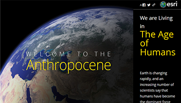
Living in the Age of Humans

A series of stories examining the planet-wide impacts of human activities.

Connecticut's Changing Landscape

This StoryMap contains interactive maps that let the user explore various aspects of landscape change in Connecticut.

Connecticut Environmental Conditions Online

CT ECO is an interactive mapping site that showcases all available statewide data layers related to natural resources and the environment.
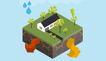
WikiWatershed Runoff Simulation Model

This interactive simulation allows users to change parameters controlling stormwater runoff and understand the interplay of these factors.


WikiWatershed Models

Users can explore stormwater runoff quality and quantity in a given watershed or area of their choice.
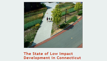
State of LID Story Map

Explore the results of a statewide survey of the LID regulations in CT towns, and the major factors impacting the use of LID practices.
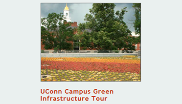
UConn Campus Green Infrastructure Tour

This story map is a tour of the Green Infrastructure or Low Impact Development (LID) practices on the main UConn campus in Storrs.
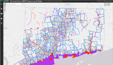
MS4 Map Viewer

Use this map to find the impaired waters in your area and see how much impervious cover is in your town and your watersheds.

Other Online Resources

CLEAR Story Map Gallery

One-stop shopping for CLEAR story maps – there’s a few in here, besides the ones listed above, that might be of interest (bears, anyone?).  Created by CLEAR.

ConnectED

Ready-to-use educational modules that make use of the internet mapping technology ArcGIS Online. Created by industry leader Esri.

Esri Story Map Gallery

Hundreds of curated story maps on a wide range of topics. Gallery created by industry leader Esri. Story maps created by GIS users.

UConn Map and Geographic Information Center (MAGIC)

The UConn Map and Geographic Information Center. The place to go for online historical maps, including the 1934 statewide aerial photos. Created by the UConn Library.

StreamStats

An online mapping tool that allows the user to delineate the watershed of any chosen point on a stream, and generate a map and some key information about that area. Created by the US Geological Survey (USGS).

Rain Garden App: Free smart phone application with everything you need to build your own “rain garden” low impact development practice.

What is GSI/LID? These interchangeable terms both refer to the use of natural methods to absorb rainfall and runoff.

National LID Atlas: An interactive map of LID practices with examples from across the country.

Eagleville Brook Real Time Monitoring Website

Human Impacts on Local Water Resources (American Biology Teacher)

Access the full Unit Planning Template or individual lessons by day (cards below).


Day 1: Modeling the Health of Three Local Water Resources

Days 2-3: Determining Water Quality and Biodiversity

Days 4-6: Modeling Water Flow through Ecosystems

Day 7: Human Impact on Land and Water

Days 8-9: Ecological Functions & Services

Day 10: Human Decision Making

Days 11-12: Revisiting Models

Extending the Unit: EcoJustice

Extending the Unit: Low Impact Development

TPL At-a-Glance

47

Teachers

42

Schools

39

Towns

group photoconducting researchgathering datagathering datapeople comparing data outsidegroup photoresearch in a labresearch in a labpeople listening to a speakerpeople taking notes outsidegroup photo
TPL Instructors

Name

Position/Title

Department/Affiliation

ChesterArnold

Chester Arnold

Extension Educator and CLEAR Director

Department of Extension; Center for Land Use Education and Research

ToddCampbell

Todd Campbell

Professor of Science Education

Neag School of Education

CaryChadwick

Cary Chadwick

Geospatial Training Program Coordinator

Department of Extension; Center for Land Use Education and Research

LauraCisneros

Laura Cisneros

Assistant Extension Professor

Department of Natural Resources & the Environment; Institute of the Environment

DavidDickson

Dave Dickson

NEMO Co-Director and Mobile Mapping Educator

Department of Extension; Center for Land Use Education and Research

MichaelDietz

Michael Dietz

Water Resources Extension Educator and Director of the Connecticut Institute of Water Resources

Department of Natural Resources & the Environment

DavidMoss

David Moss

Associate Professor and Director of Global Education

Neag School of Education

LauraRodriguez

Laura Rodriguez

Doctoral Candidate

Neag School of Education

JohnVolin

John Volin

Vice Provost for Academic Affairs and Professor

Office of the Provost and Department of Natural Resources & the Environment

EmilyWilson

Emily Wilson

Geospatial Educator

Department of Extension and Center for Land Use Education & Research

MichaelWillig

Michael Willig

Professor and Director

Department of Ecology and Evolutionary Biology; Center for Environmental Sciences and Engineering

Program Funding

NRCA’s Teacher Professional Learning (TPL) program is supported through an Assistance Agreement (#NE00A00834) awarded by the U.S. Environmental Protection Agency (EPA), as part of their Environmental Education Grants Program. The views expressed on this webpage are solely those of the University of Connecticut and EPA does not endorse any products or commercial services mentioned herein.

logo

Previously, the Teacher Professional Learning program was supported by a grant (PD-STEP 2016-05148) from the USDA National Institute of Food and Agriculture (NIFA) Agriculture Food and Research Initiative Education and Literacy Initiative, as part of their Professional Development Opportunities for Secondary School Teachers program.